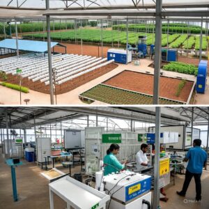
Agriculture in Kerala is undergoing a digital transformation. Farmers are increasingly adopting satellite data and modern technology to improve crop yields, conserve resources, and adapt to changing climate conditions. Although traditional farming techniques still matter, satellite technology is helping transform farming into a precise, efficient, and sustainable practice.
Below, we explore how Kerala’s farmers use satellite data—from crop monitoring to smart irrigation—and how this space-age technology is changing agriculture from space to soil.
Monitoring Crop Health with Satellite Technology
-
Normalized Difference Vegetation Index (NDVI):
This tool helps farmers assess crop health by detecting stress due to water shortage or nutrient deficiency early, before visible symptoms appear. -
Pest and Disease Detection:
Satellite sensors analyze crop spectral signatures to identify early signs of pest infestations or diseases, allowing timely and targeted intervention. -
Hyperspectral Imaging:
Advanced satellite imaging captures subtle physiological changes in crops, such as fungal infections, crucial for Kerala’s spice and vegetable farmers.
Consequently, these technologies enable farmers to act swiftly, reduce crop losses, and minimize pesticide use.
Climate-Responsive Farming: Adapting to Kerala’s Changing Weather
-
Real-Time Rainfall Monitoring:
Satellite data provides accurate rainfall and temperature updates that help farmers adjust sowing schedules accordingly. -
Heat Stress Alerts:
Monitoring land surface temperatures helps identify heat stress in crops, enabling preventive irrigation or shading.
Although monsoon patterns are unpredictable, satellite technology helps farmers adapt better and reduce risks from extreme weather.
Optimizing Water Use with Remote Sensing
-
Soil Moisture Analysis:
Satellites track soil moisture levels, guiding farmers on the precise timing and quantity of irrigation needed. -
Targeted Irrigation:
Instead of watering entire fields, farmers can apply water only to dry zones, conserving water and reducing costs.
Therefore, satellite-driven irrigation management is critical in Kerala’s water-scarce regions, improving efficiency and sustainability.
Smart Fertilizer Planning and Resource Efficiency
-
Soil Nutrient Mapping:
Satellite data helps create maps indicating nutrient-rich and nutrient-poor zones for precise fertilizer application. -
Weather-Linked Fertilizer Use:
Real-time weather forecasts prevent fertilizer loss due to heavy rains, ensuring nutrients reach crops effectively.
Thus, fertilizer use becomes more efficient, cost-effective, and environmentally friendly.
Sustainable Land Management Using Satellite Data
-
Detecting Land Degradation:
Satellite imagery identifies early signs of soil erosion, landslides, and vegetation loss, especially in Kerala’s hilly terrain. -
Utilizing Fallow Land:
Satellite data helps locate unused lands and assess their potential for cultivation or agroforestry.
As a result, farmers and authorities can take preventive measures to protect soil health and make better land use decisions.
Crop Diversification and Zonal Crop Recommendations
-
Soil and Climate Analysis:
Satellite data provides insights into soil type, temperature, and rainfall, helping farmers choose suitable crops. -
Microclimate Trial Zones:
Farmers can test new crops in small areas before expanding, minimizing risk and encouraging innovation.
Consequently, crop diversification improves income stability and agricultural sustainability.
Empowering Farmer Cooperatives and Smallholders
-
Shared Satellite Data:
Farmer cooperatives use satellite maps for coordinated resource management, such as fertilizer distribution and machinery use. -
Disaster Recovery Planning:
Post-disaster satellite maps guide replanting and soil restoration efforts to speed recovery for vulnerable smallholders.
Hence, satellite technology strengthens community farming and resilience.
Access to Real-Time Weather and Market Information
-
Weather Updates:
Farmers receive timely alerts on weather changes to protect crops and schedule harvests efficiently. -
Market Forecasts:
Satellite-linked apps provide market trends, helping farmers decide the best time and place to sell produce.
Therefore, access to information enhances profitability and reduces uncertainty.
Government Support and Digital Literacy
-
Training and Digital Tools:
Kerala’s government and agri-tech startups provide training and satellite data through apps in local languages. -
ISRO BHUVAN Portal:
This platform offers free access to satellite imagery and analysis tools for farmers.
Moreover, these initiatives make space technology accessible even to smallholder farmers.
Shaping a Smarter, Sustainable Agricultural Future for Kerala
-
Kerala farmers are embracing satellite data to transform traditional farming into a data-driven, efficient, and sustainable practice.
-
From monitoring crop health and optimizing irrigation to precise fertilizer use and land management, satellite technology enhances productivity and resilience.
-
Despite challenges, government support and digital literacy efforts are enabling even small-scale farmers to benefit from these innovations.
-
Ultimately, Kerala is nurturing a future where space technology and soil science work together to secure sustainable farming and food security.

Leave a Reply